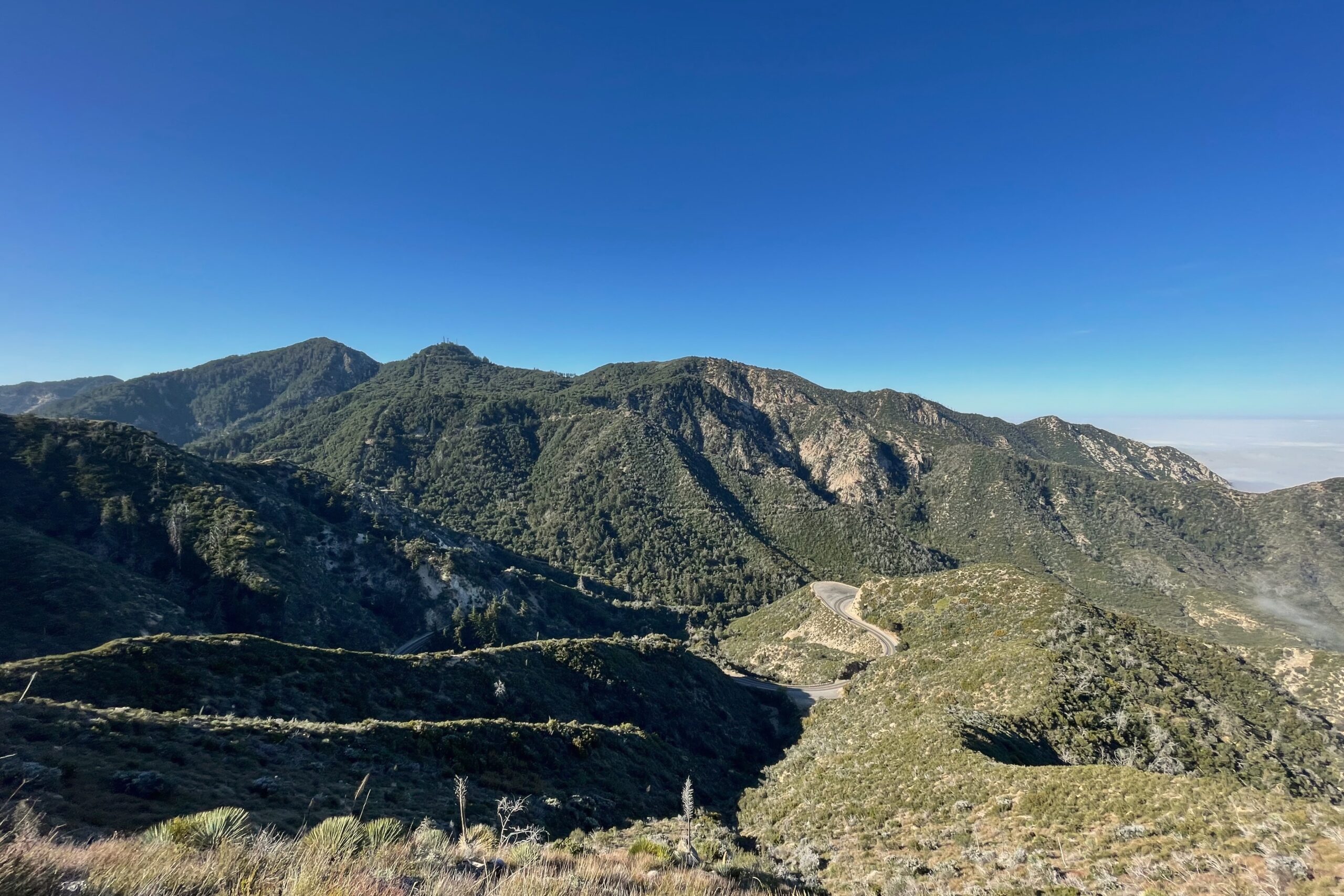
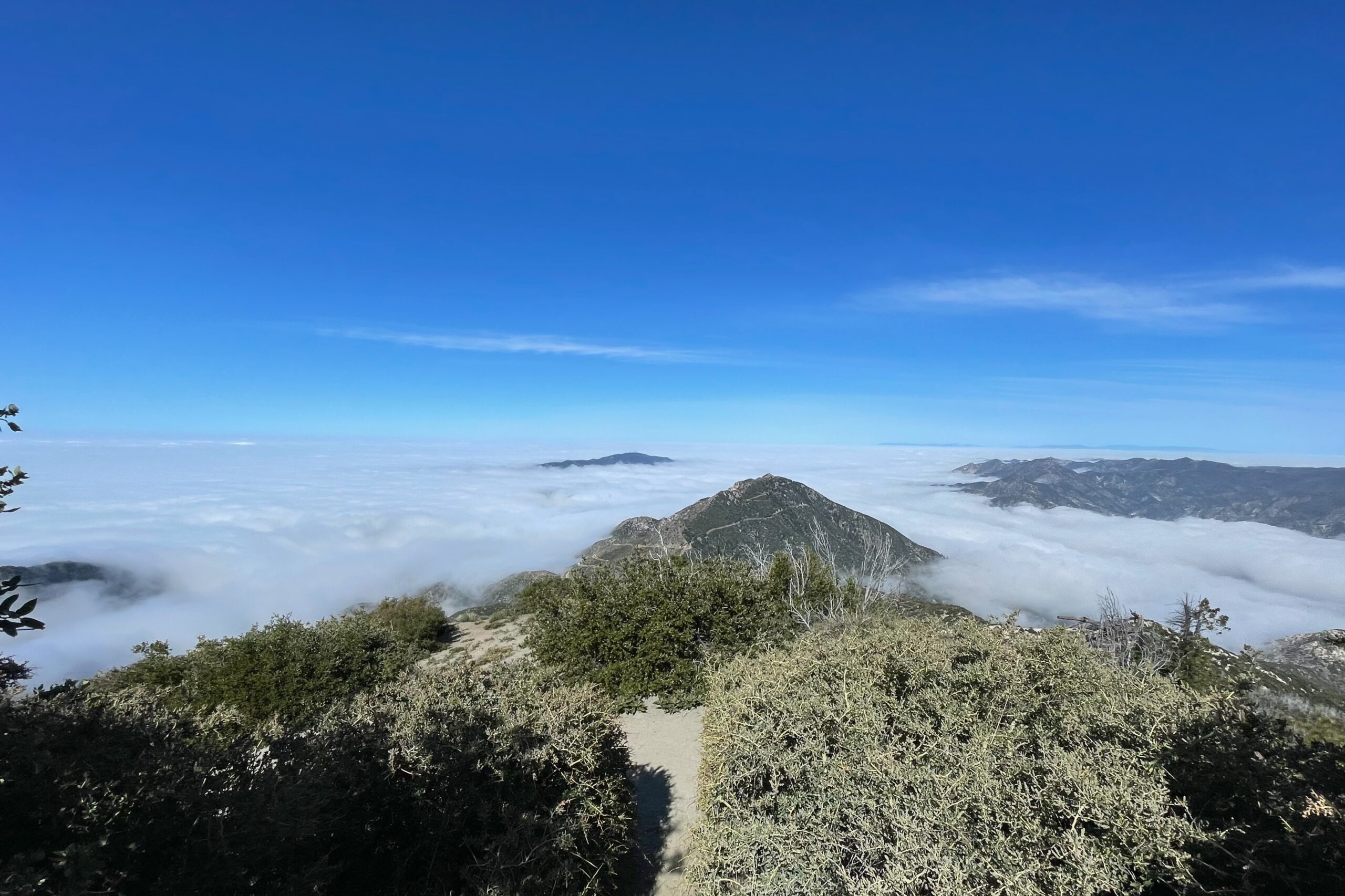
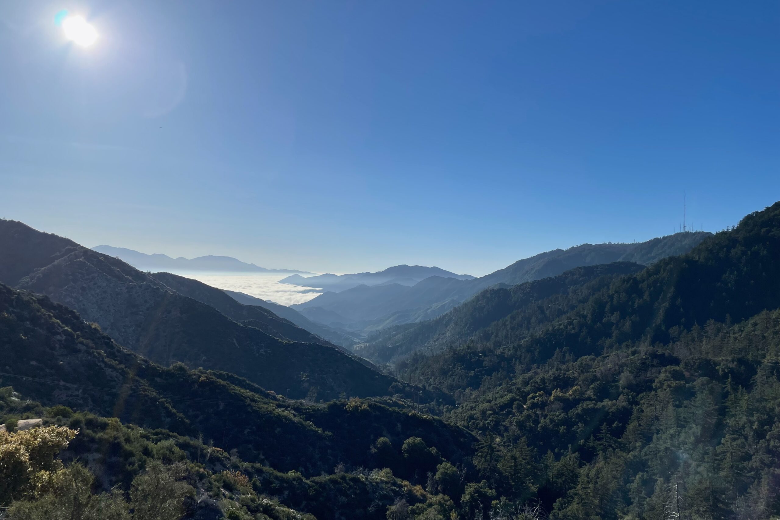
I decided to take my parents out for a hike in the Angeles National Forest. With the section of SR-2 from Mount Wilson Red Box Road to just west of Upper Big Tujunga Canyon Road closed for the season, I thought getting out to this little pocket of peaks would make for an ideal Saturday morning. We arrived at the trailhead around 07:30 AM and the parking was already getting busy.
My parents are healthy and their fitness levels are quite good. Although, hiking is a bit out of their comfort zone, so we cruised the first few miles to the base of Strawberry. At that point the trail changed and started getting much steeper. The trail to Strawberry is well-marked and busy on the weekend. I must have seen at least a dozen people on the way up.
With no cell service, I was relying on the Reverse Beacon Network to pick me up and spot me based on the alert I had set the day before. I started with the Yaesu FT-817ND on 40M and quickly gathered a few contacts. Moving over to the other bands, I didn’t hear anything on 20M or 15M, but got two contacts on 10M before a group of young engineers stopped and wanted to talk about what I was doing. They were really nice and I always try to be as pleasant and educational as possible when I’m out activating busy summits. VHF was impossible since I had left my band-pass filter in the car.
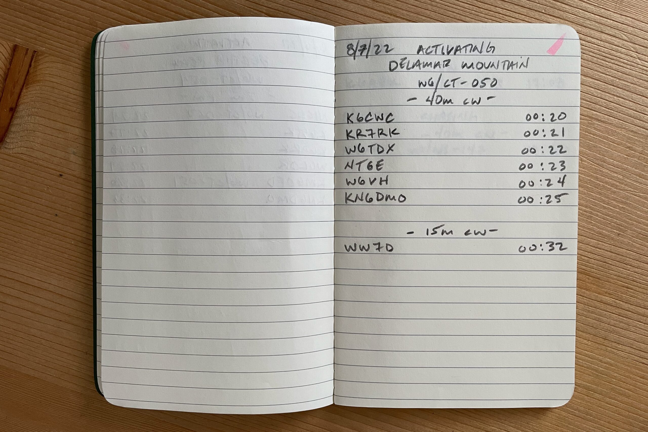
Sugarloaf has been on my shortlist for a while now and I had a half-day opening so I went for it. Parked at the San Juan Trail Trailhead inside Blue Jay Campground around 06:15 AM with an alert for Sugarloaf set at 08:00 AM. Glad I set that alert because there was no service on the summit. I need to figure out how to post spots via APRS.
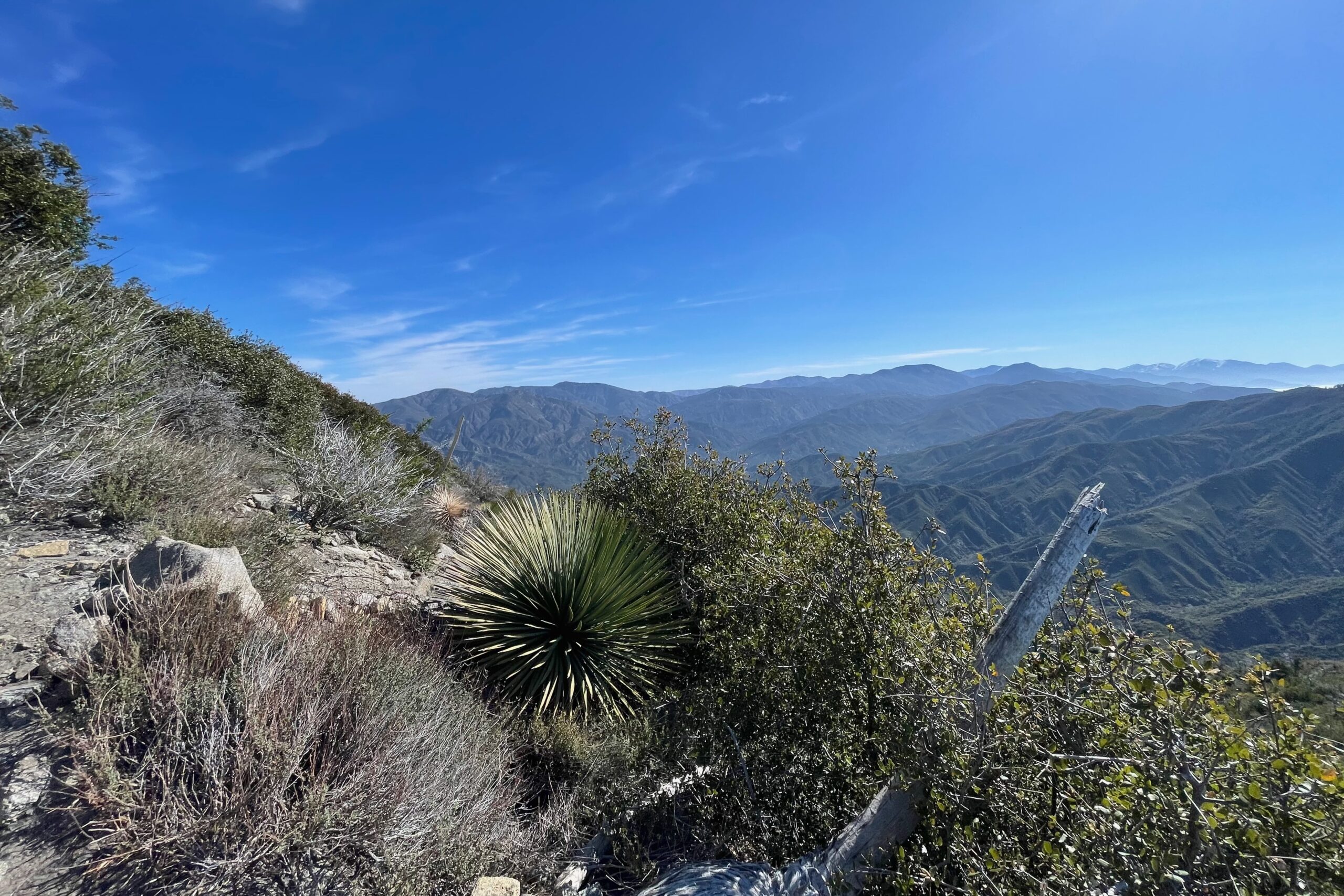
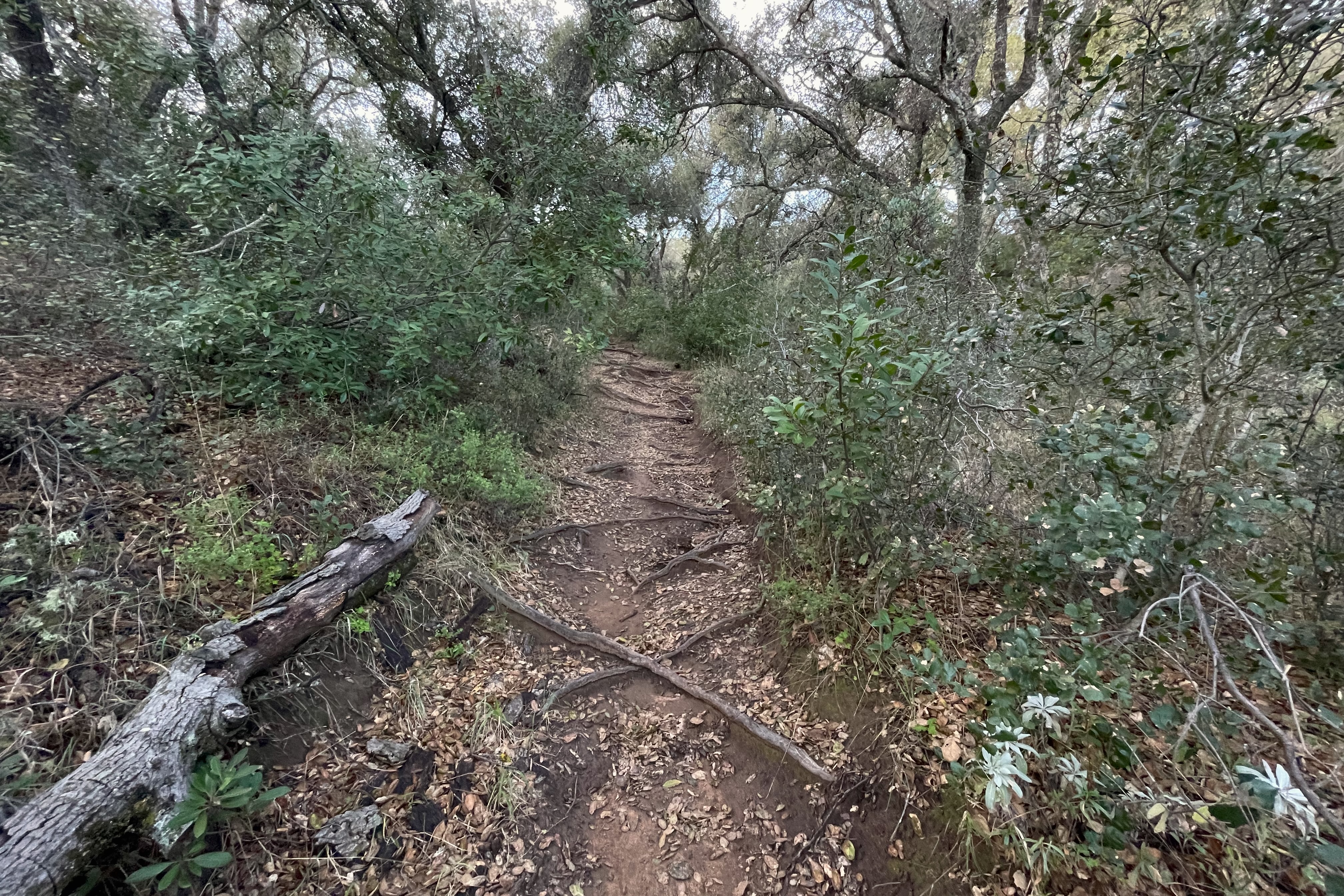
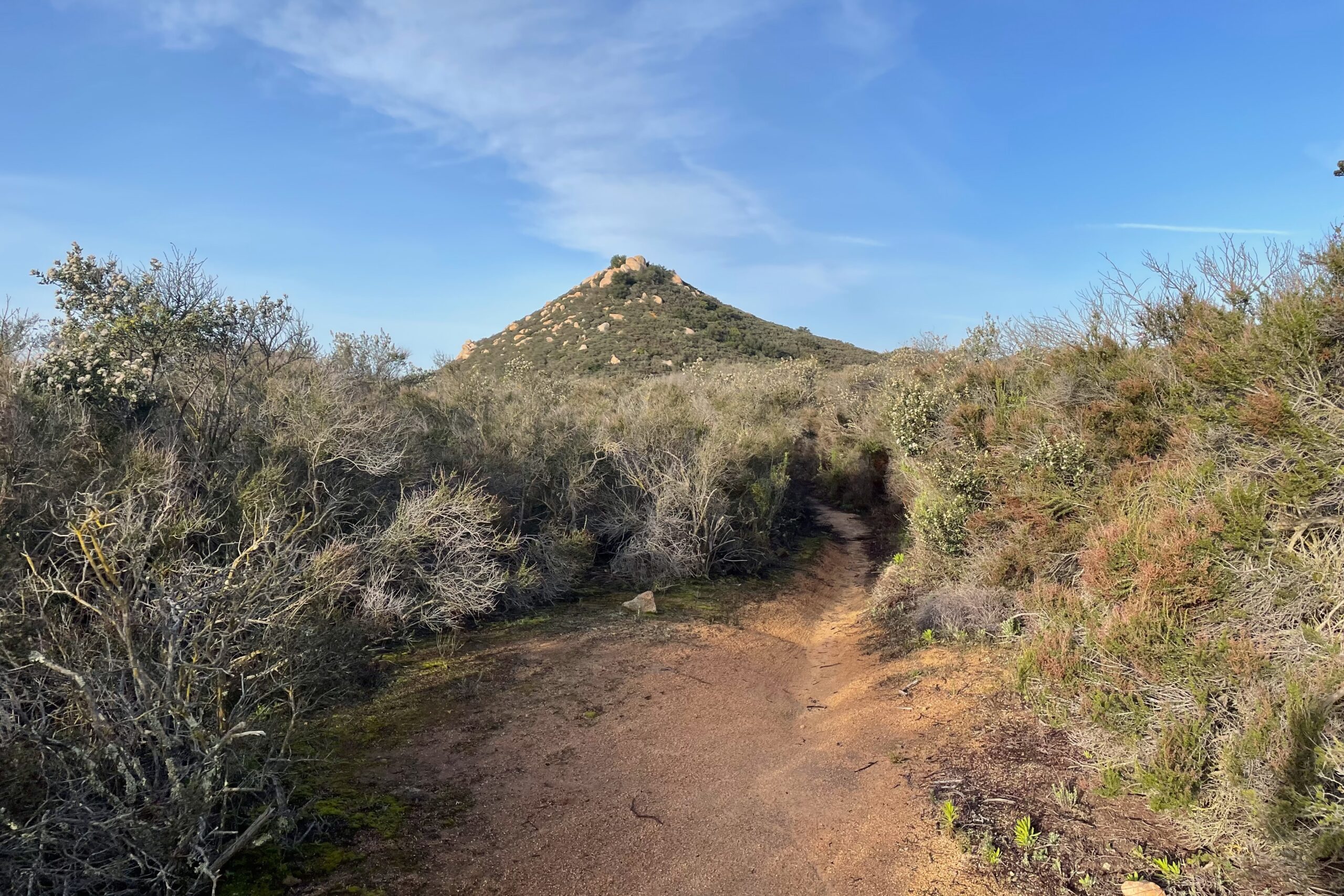
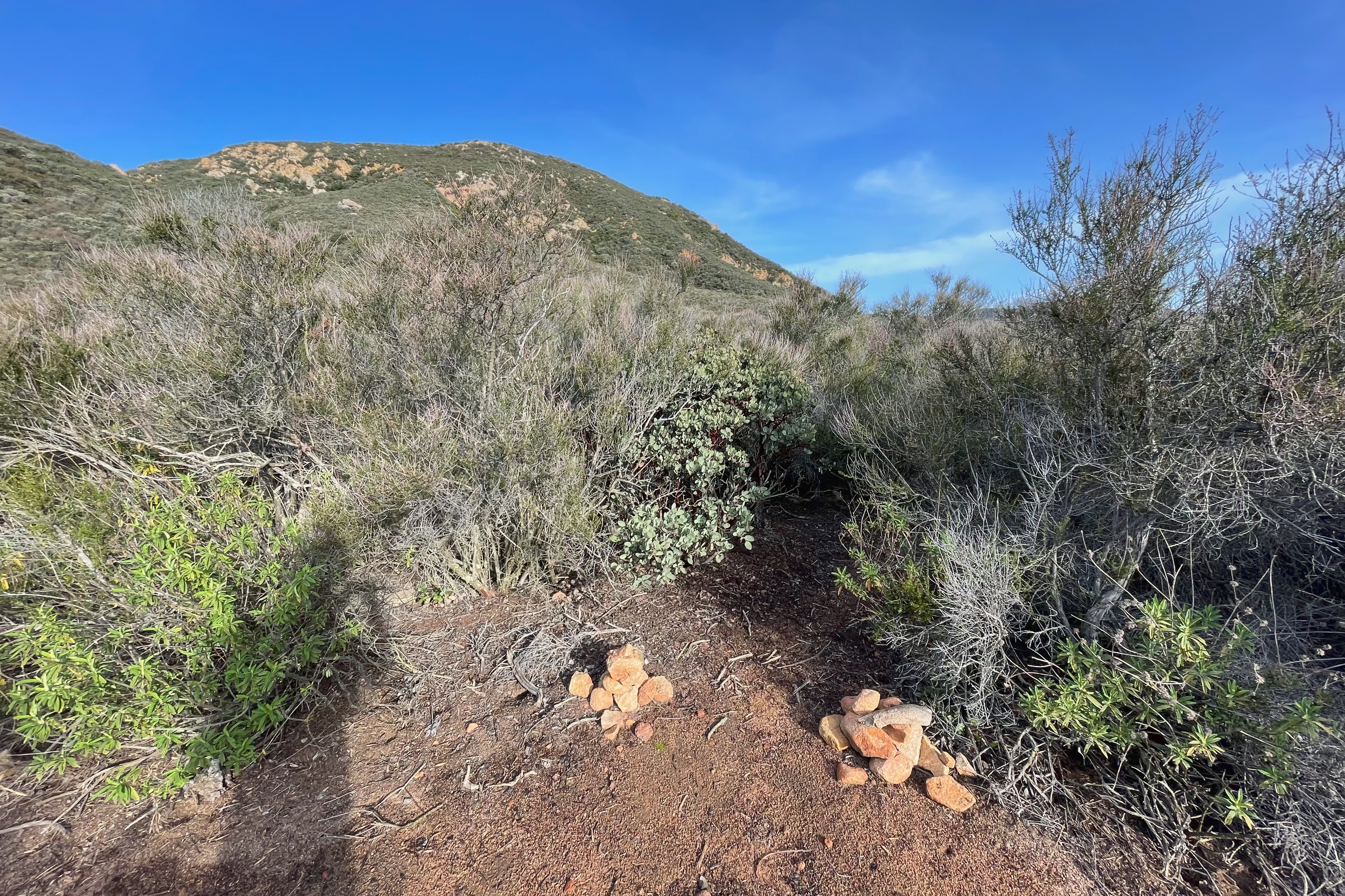
The trail starts out very runnable with a gradual decline down to about the 1.5mi mark. From there it’s a push-up to the wrong Sugarloaf, skirt around that guy, and head down the backside to find the main event. One more drop into the valley/saddle and you’ll find that some decent person has set up some cairns to steer you up the right trail. From there it becomes very overgrown, I wish I had worn pants and a long sleeve. It’s a steep punch to the summit. Wasn’t terrible. Just be prepared for a good incline to get to the top.
Activation was a blast, using a new-to-me Yaesu 817ND paired with a 40M EFHW. I got a few DX and overall just had a great time with the sun warming me up just right the whole time I was on the summit. Didn’t see another soul until I was halfway back to the car.
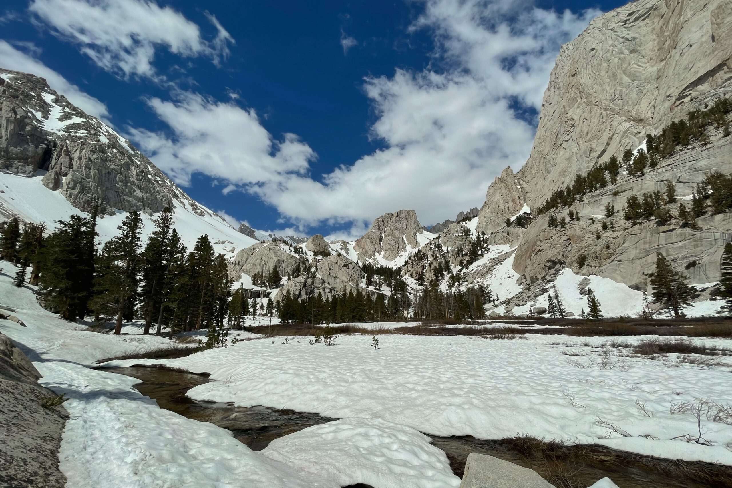
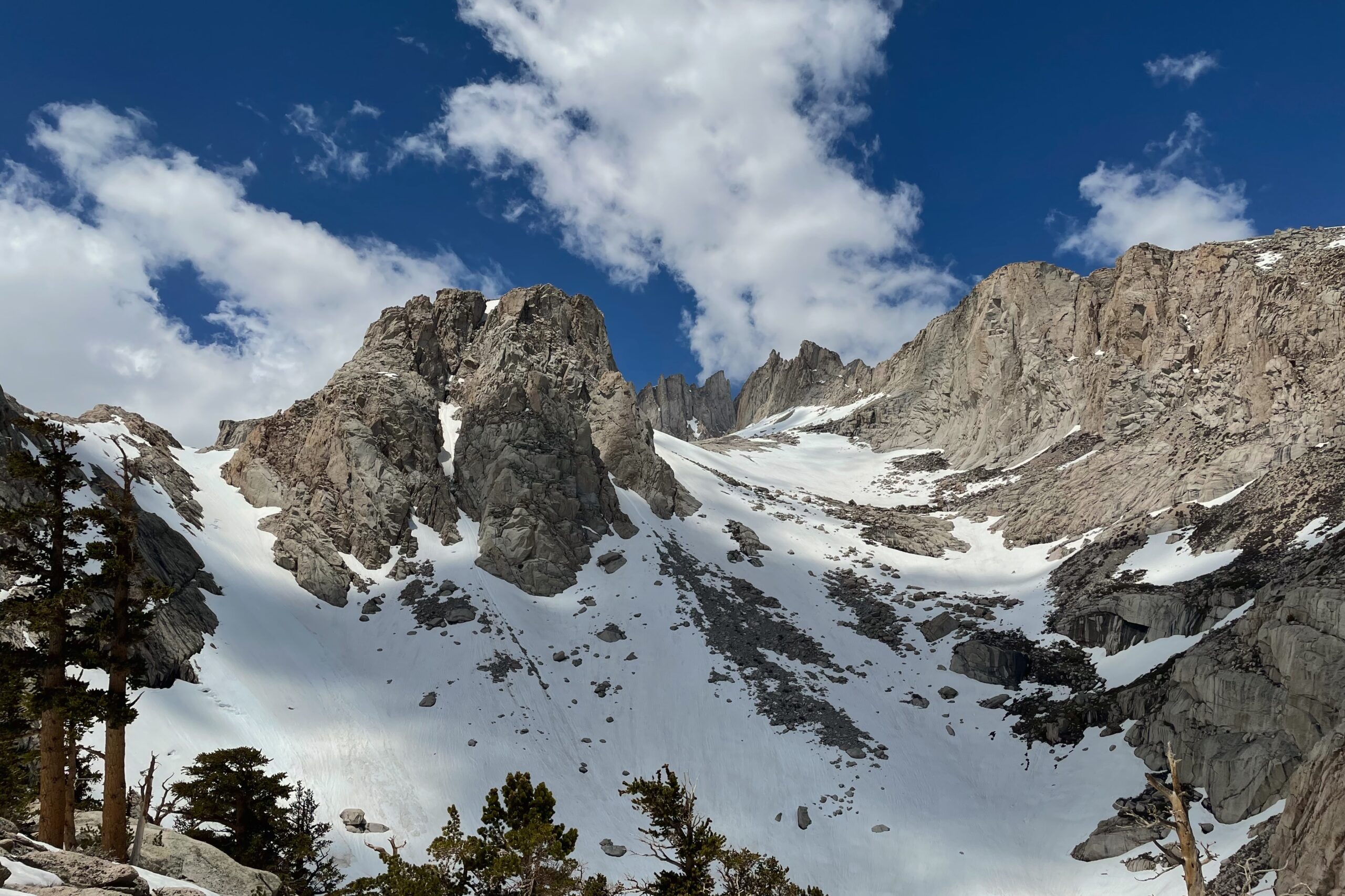
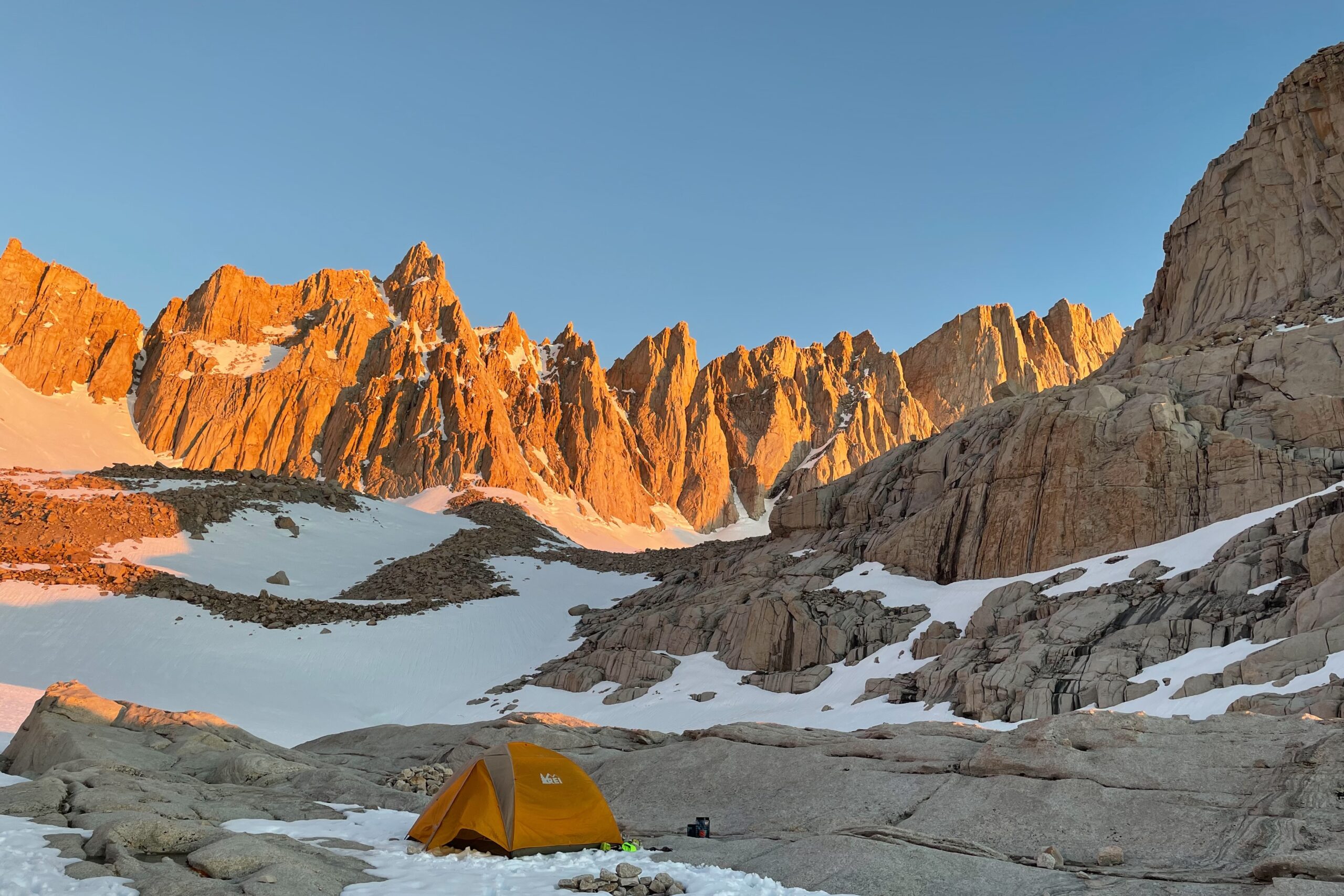
I arrived at Whitney Portal and was greeted with rain and an epic lightning display off to the east. Sleeping in the back of the car that night, I got an early start the following morning and started to pick my way up to trail camp.
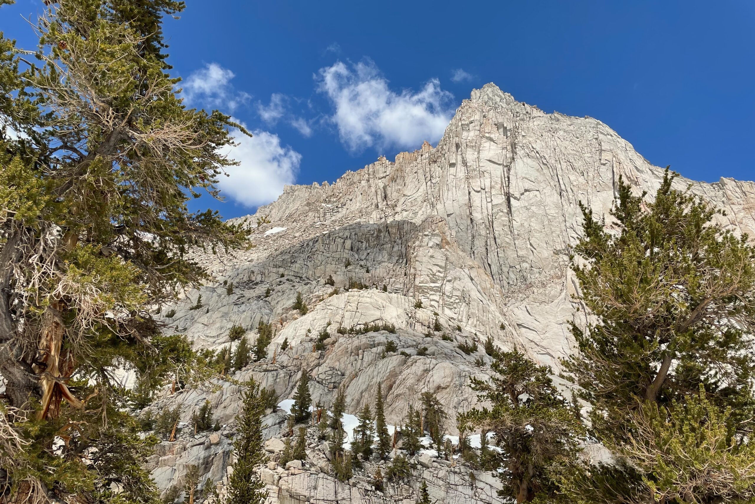
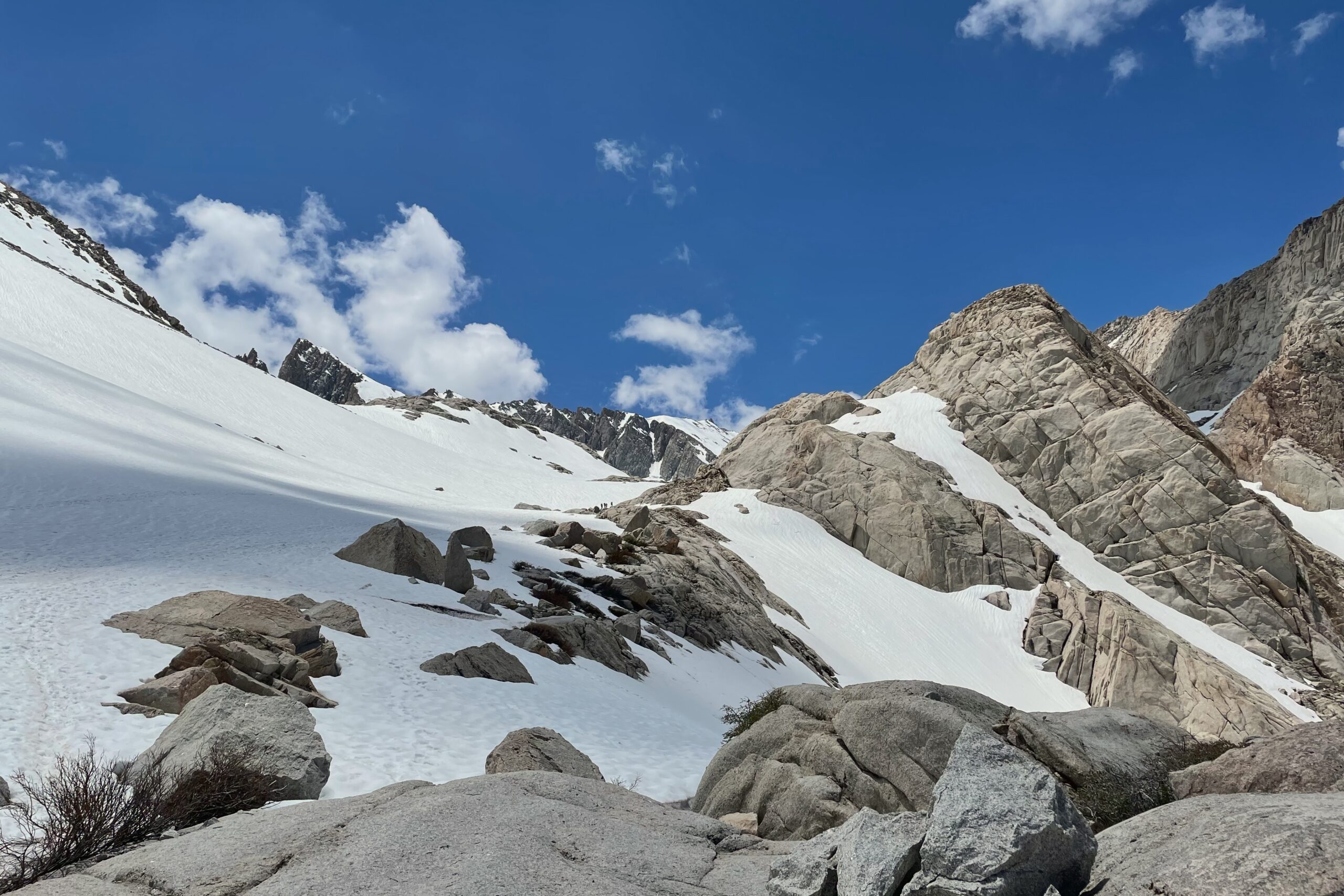
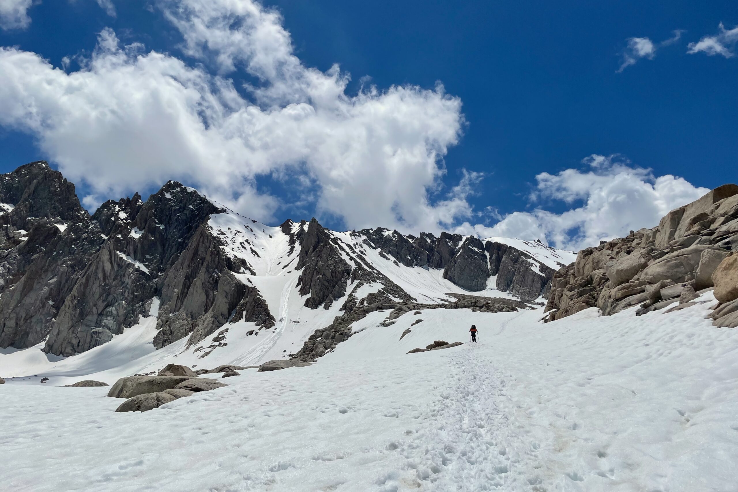
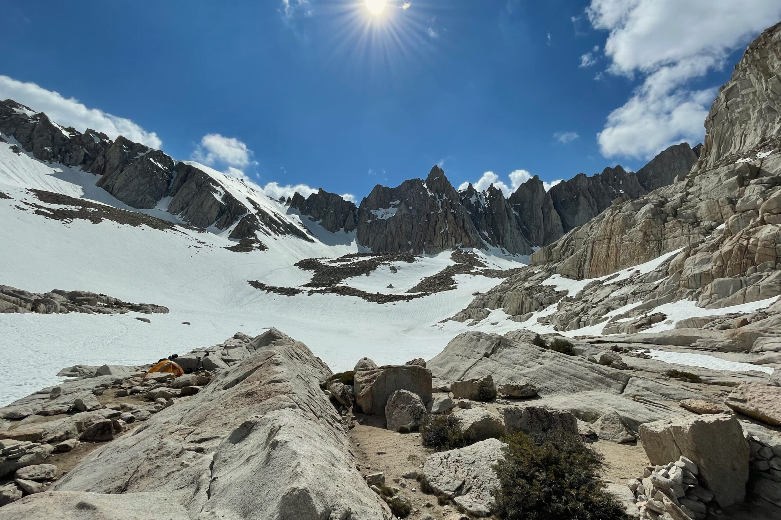
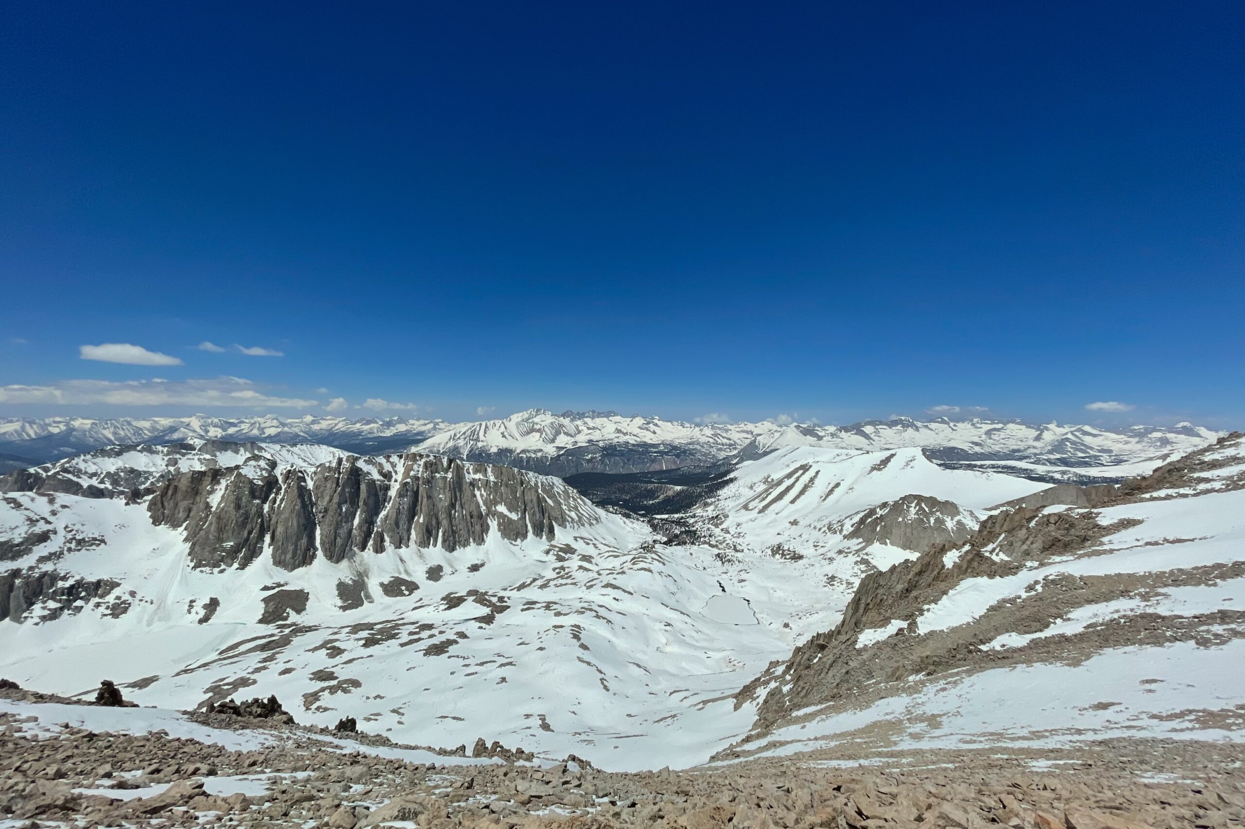
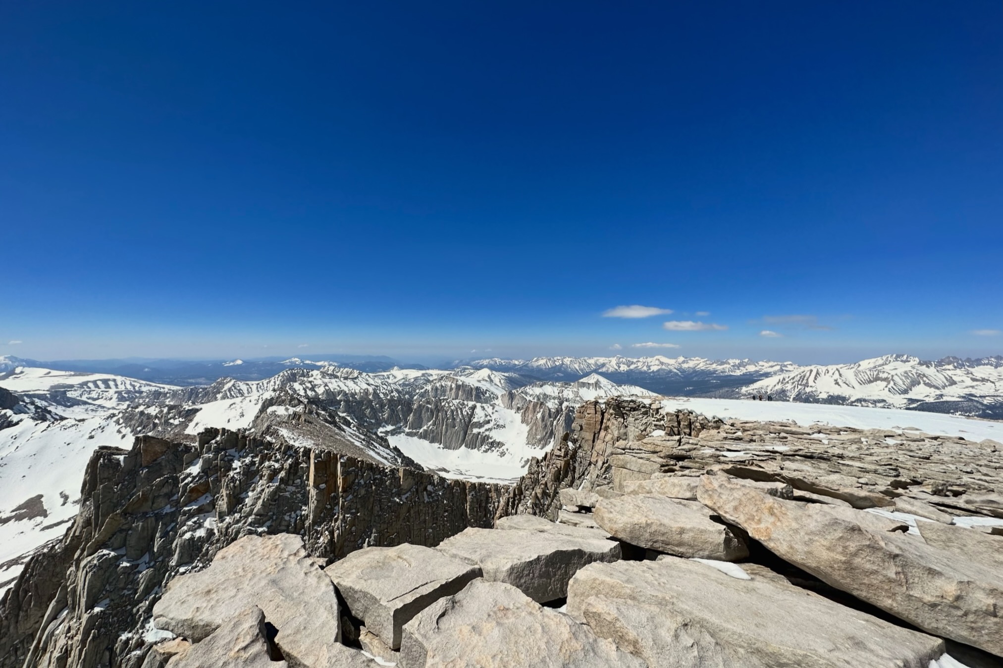
It was a heavy snow year and there was avalanche debris for the first few miles. Within an hour of hiking, the trail was gone and the crampons went on. It was a pretty brutal slog up the mountain mostly following tracks that cut through the (what would have been) switchbacks. I crossed over two ice bridges on the way up, the second, I wish I hadn’t, and found a better route on the way back down. Arriving at Trail Camp later that afternoon, I slept like a baby and started up The Chute the following morning around 5:00AM. It took almost two hours to get up The Chute to Trail Crest. After traversing over to the summit, there was another, shorter punch-up to the top that felt a little risky, but with only a few hundred feet of gain left, and clear skies, it was an easy choice.
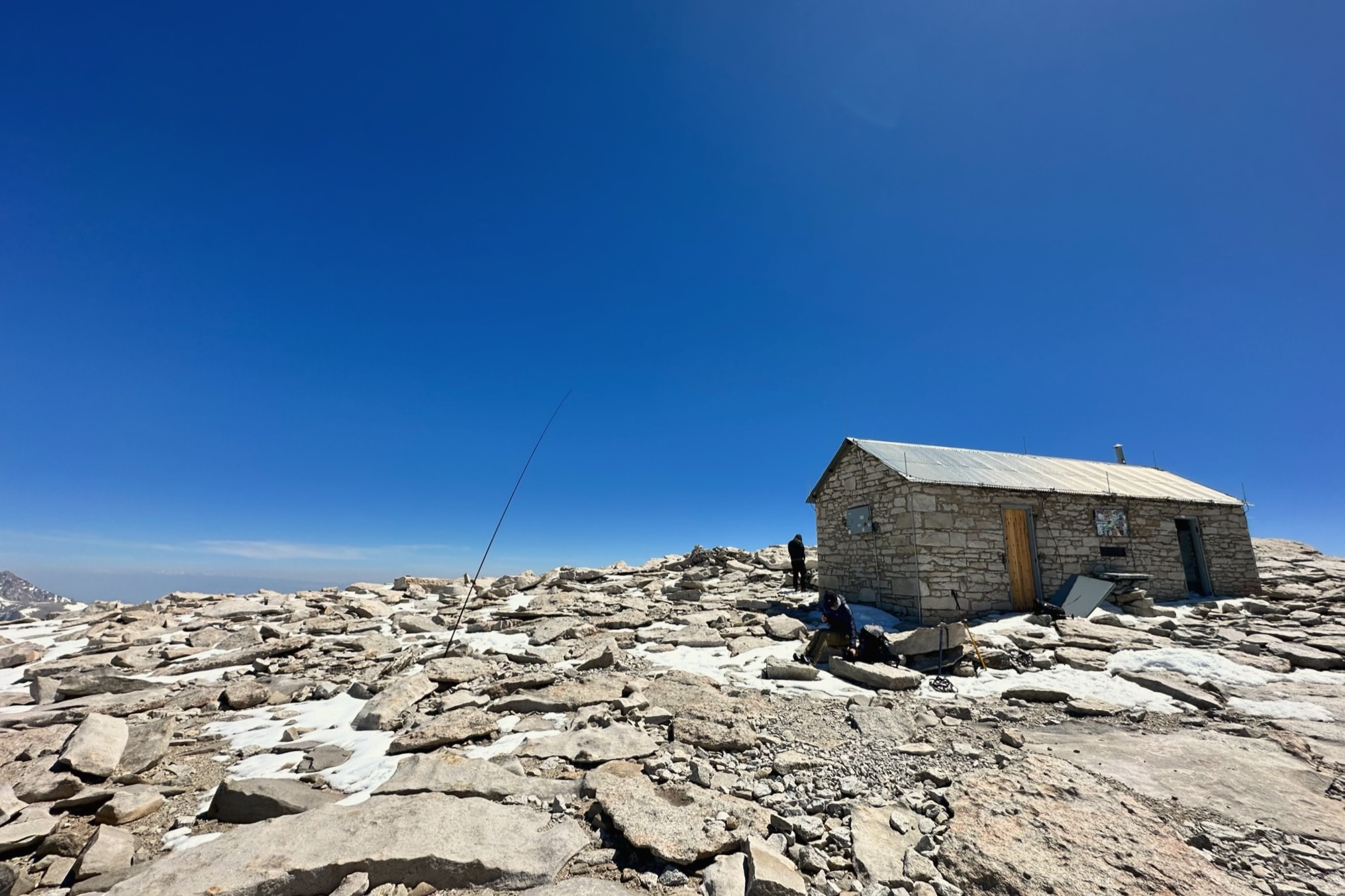
After reaching the summit marker, I found an area with minimal wind and threw the mast up, wedging it between a few rocks. Starting on 20m, the pile-up happened quickly, as you might expect after sending out a spot for a 001 summit. Luckily, I was able to pick out the usual suspects from the chaos without issue. QSB became an issue at some point and I lost at least two callers in the fading during my time activating.
The way back to the car was fairly swift. Traversing back to Trail Crest was sketchy in some places, and I witnessed an avalanche on one of the faces across the valley. Arriving again at Trail Crest, I was met with the 1,200 ft icy, vertical descent that I was told to glissade. I had never glissaded before, but “when in Rome”. Passing through Trail Camp, I packed up the tent with a newfound desire to get off the mountain quickly. The pace picked up continuously with every mile of descent and I was back at the car before sundown.
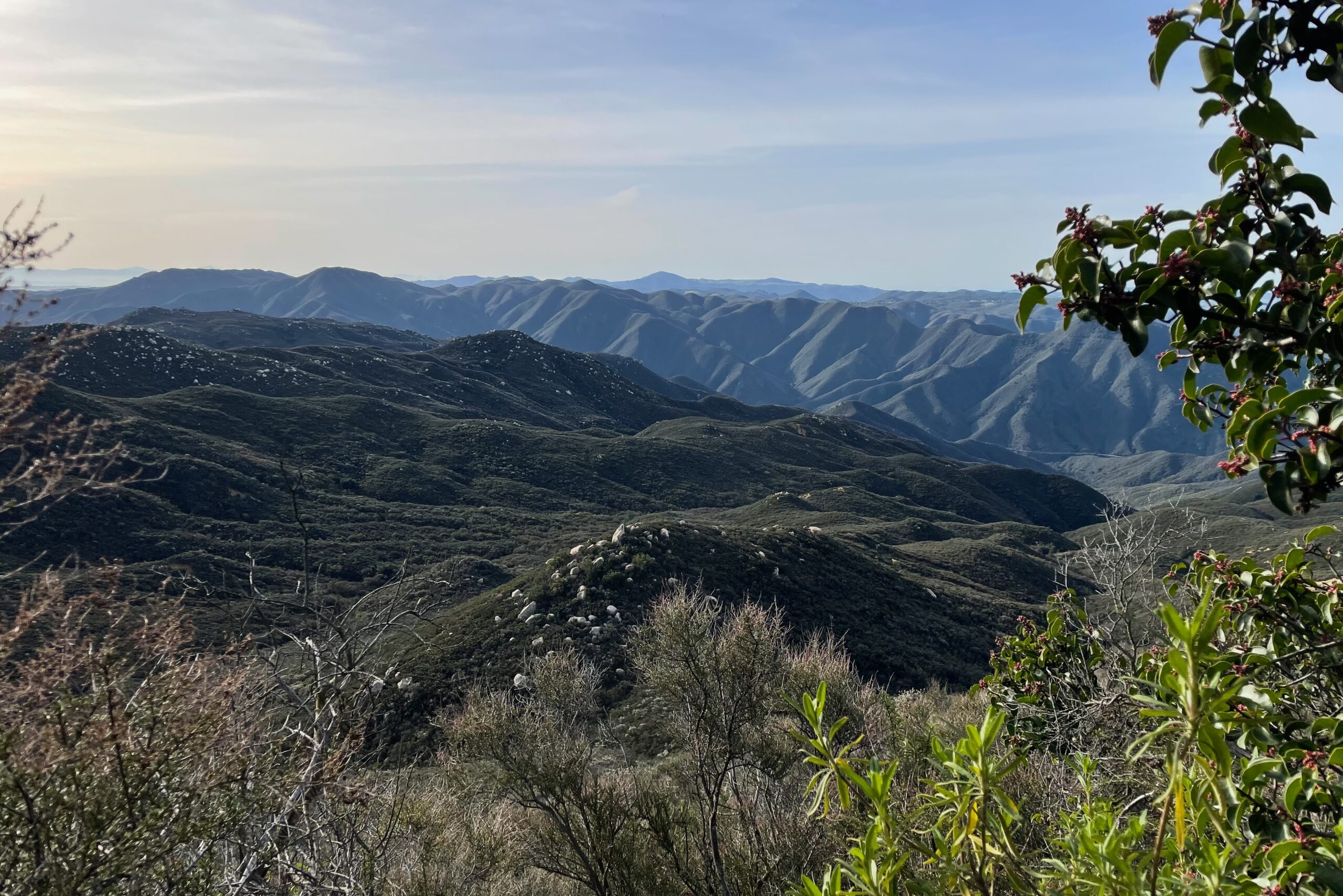
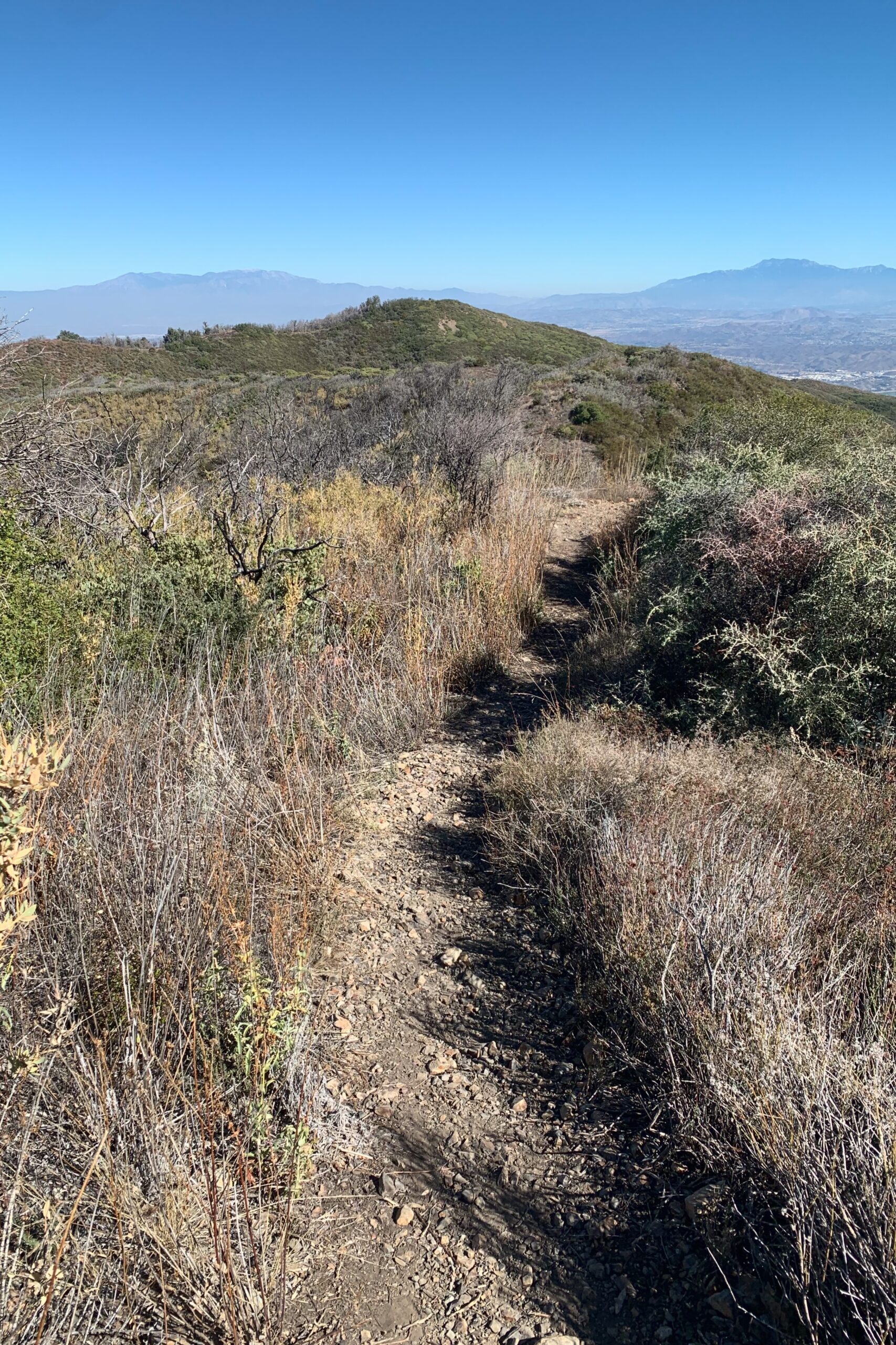
Los Pinos is a local peak just off Ortega Hwy out in the Cleveland National Forest. I took my son with me on this one since I recently sold my Prius and picked up a Subaru Forester. He was excited to drive on some dirt. Having only owned sedans before this, I was equally as excited and if we’re being honest, inexperienced. Ha!
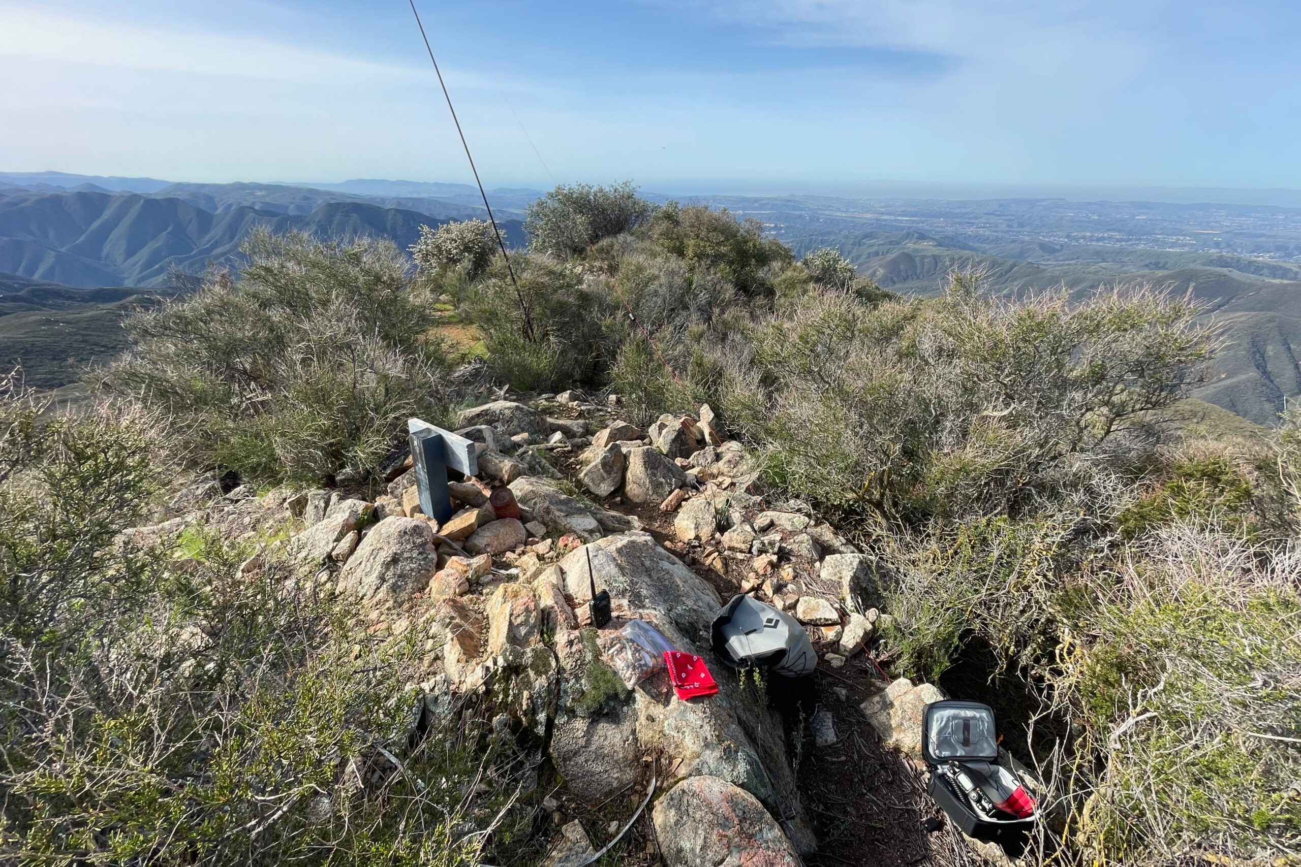
The gate to the trailhead was open so we took the fire road up in the Subaru and luckily had enough clearance to get to the parking area. I passed quite a few Jeeps and other trucks, but I was the only crossover SUV on the trail from what I saw. We parked and started making our way up to the summit. The trail was well-worn and fairly easy. By the time we reached the summit, my son wanted a snack which gave me some time to set up and activate.
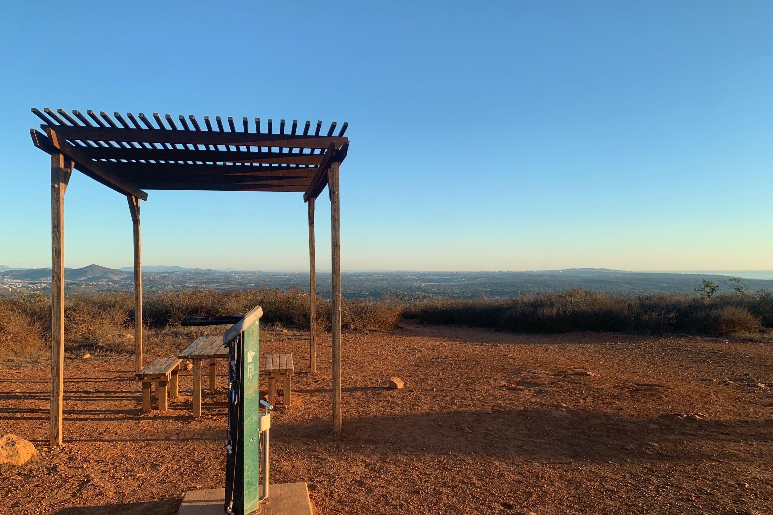
I was down in San Diego for work again, so on my way home I decided to stop and activate Denk before dinner. It’s a pretty mellow hike, and I enjoyed it after a long day. This one is runnable if you’re into trail running but watch for cyclists on the summit, my EFHW was nearly taken out a few times with guys ripping through the activation zone.
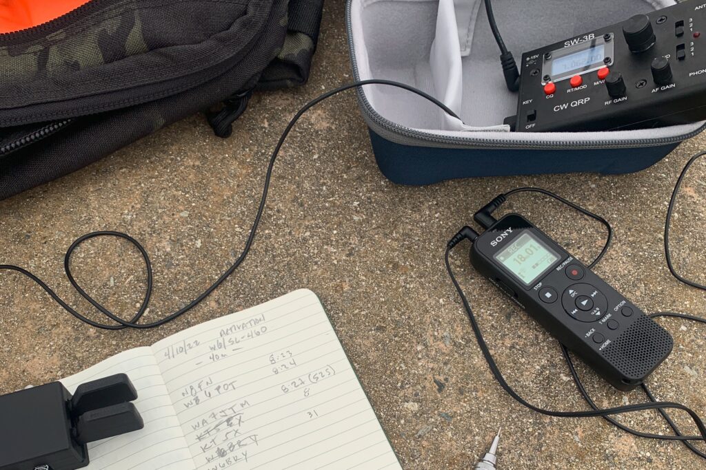
After reaching the summit, I set up on the picnic bench with my SW-3B for some CW on 20M and 40M. You read that right, 20M CW! I passed my General license a few weeks ago and I’m stoked to get on some other bands. It’s funny how I’ve become so used to 40M, 20M feels completely different. The best way I can explain it is that being limited to 40M for the past year has allowed me to learn the ebbs and flows of the band; when it’s dead, and when it’s good. Using 20M now feels new and uncertain, since I’m completely unfamiliar with it. Regardless, it was a lot of fun hearing East Coast stations on 20M.
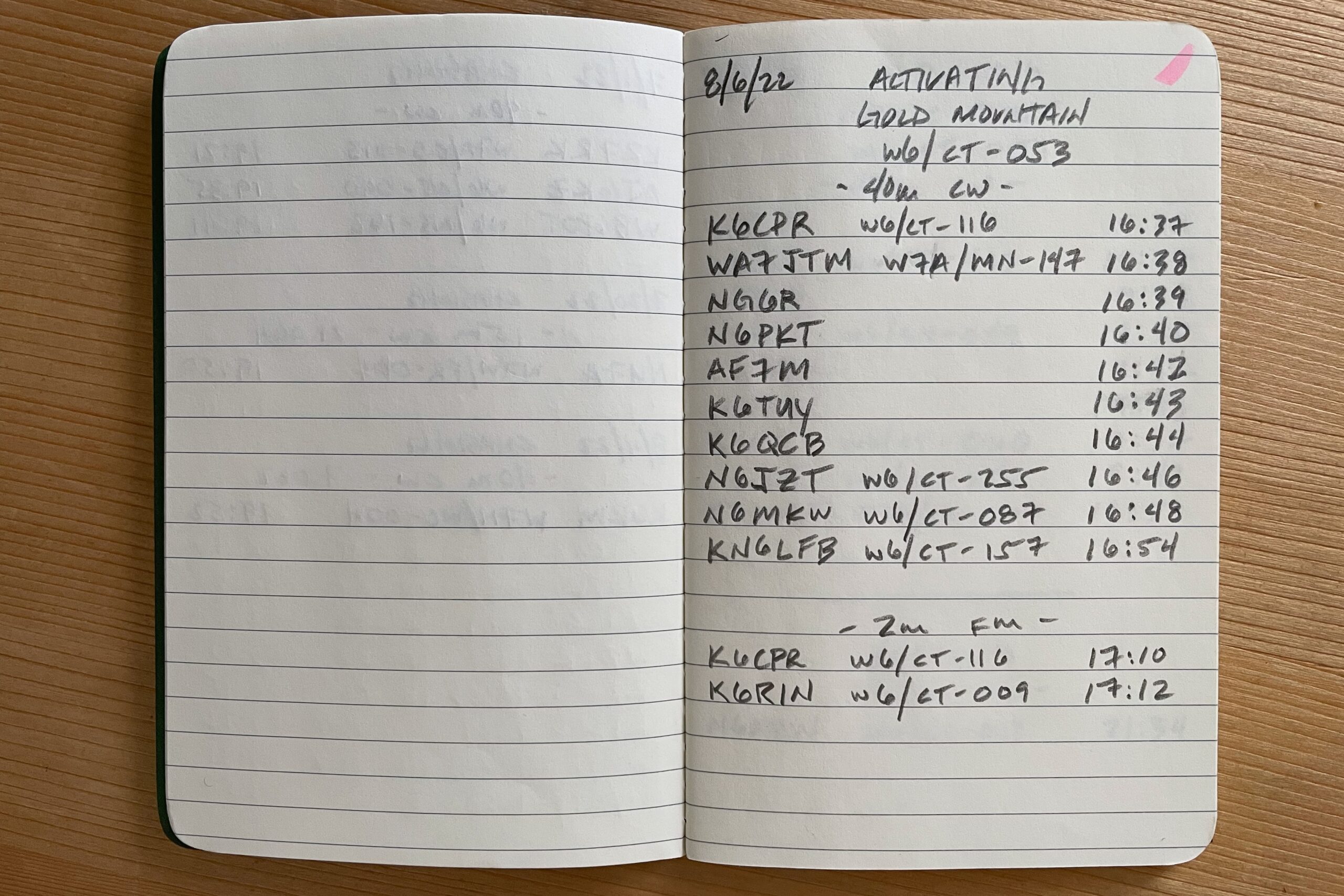
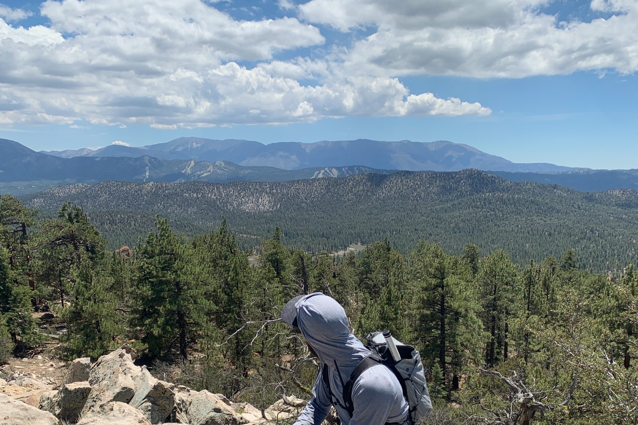
We did four peaks for SoCalSOTAFest 2022. I arrived with Kevin KN6FNY at the Tanglewood group campsite just north of Holcomb Valley in Big Bear and there was Gold Mountain just to the left of our site. Obviously, that’s where we were going to start. Everyone was awake and new arrivals were still trickling in. We hung out for a while until everyone more or less had a game plan for the day and headed out. We were joined for the day by Mike KN6EZE and his wife Linda KN6GOH.
W6/CT-053
From Tanglewood, we took the PCT toward Gold veering off when a clearing up Gold presented itself. The bushwhacking got a bit heavy through downed trees and overhead scrub brush. Once we made it through the thicker parts, it cleared and we made our way up to the summit. Pretty mellow hike if it wasn’t for the bushwhacking. I got a bit careless through a few sections and regretted it later with a long gash along my inner thigh.
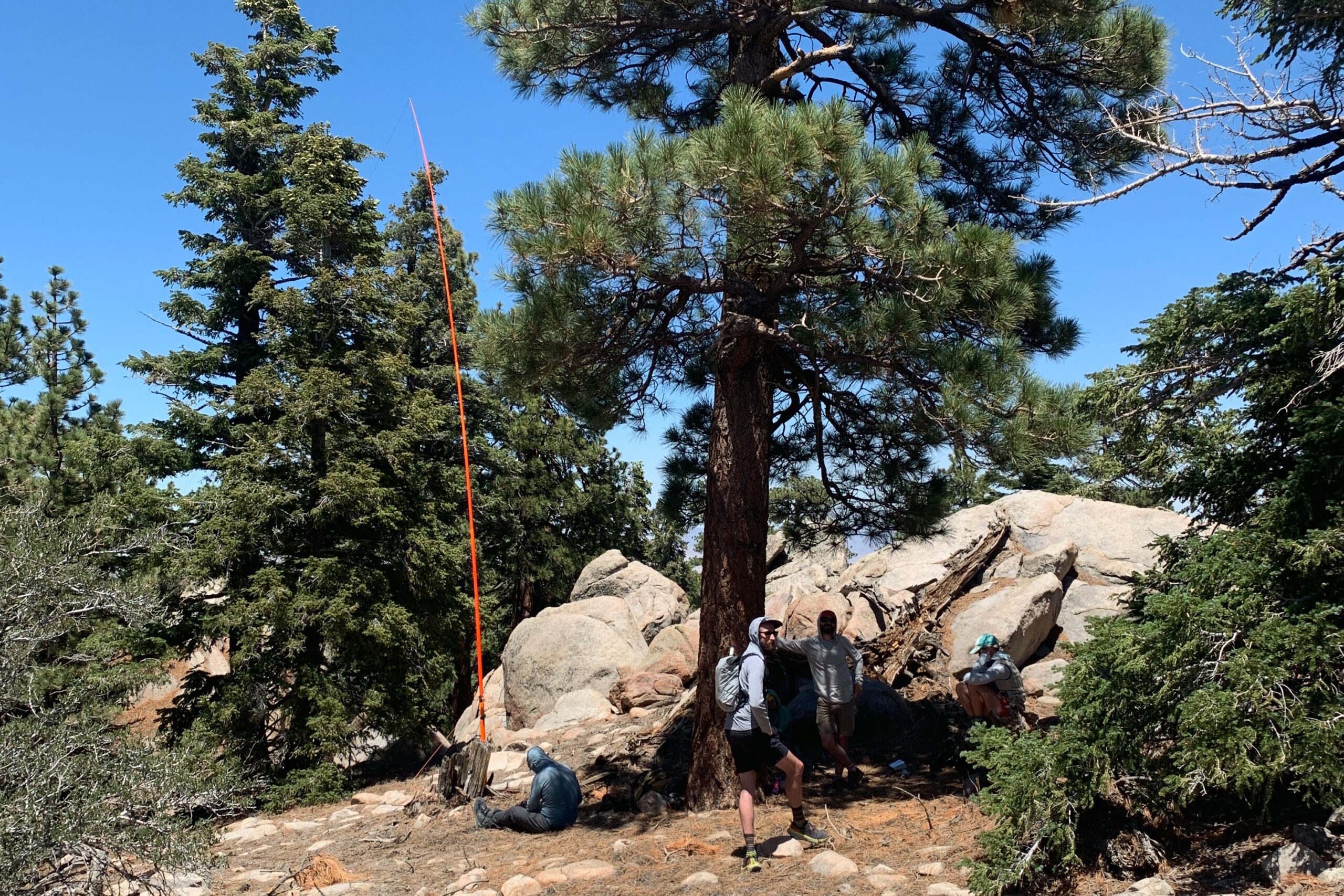
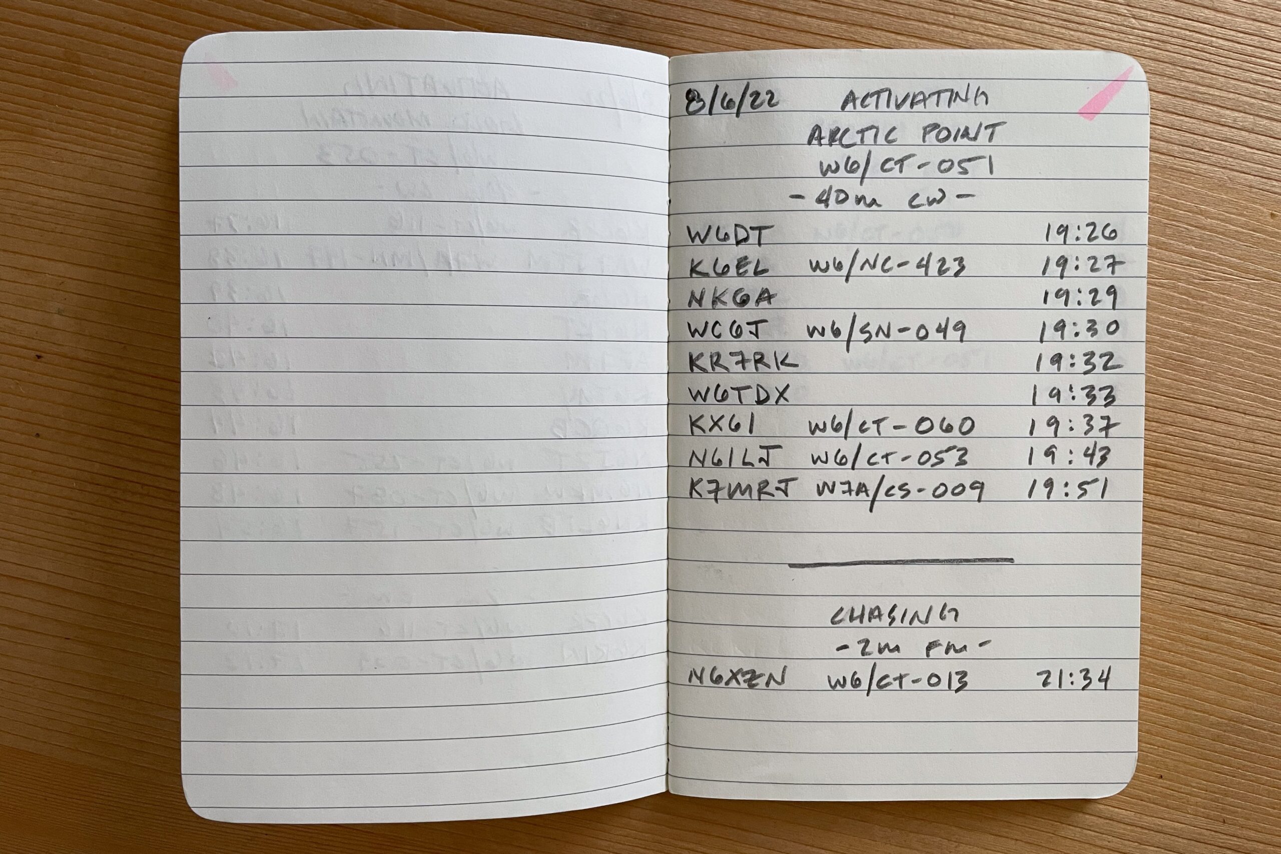
Gold’s summit is large with plenty of area to spread out multiple activators. Being a Technician, I planned to work mostly 40M CW and VHF. Getting out during an event like this is a blast, most of my contacts were other activators on other summits. After a dozen or so calls in the log, we packed up and headed over to our next peak for the day, W6/CT-051 Arctic Point.
Trailhead: We parked at the Tanglewood group campsite.
Route: Follow the PCT until it becomes clear that a straight shot up the mountain will get you there quicker and be prepared for some bushwhacking. It’s about 1mi with 1000′ of gain to the top.
W6/CT-051
Driving over to the base of Arctic, we made our way up the jeep track as far as we dared. There are some parking areas on the left side as you go up the track, we stopped at one and continued on foot up the jeep track turning east after a while to point us up Arctic. If you’re lucky, you’ll find cairns littered along one of the ridge lines. We didn’t see any going up, but as we descended later, it was clear there was a marked trail we most certainly missed.
Expect some boulder hopping and creative navigation around larger geological features. Nearing the summit there are plenty of trees if you’re curious about throwing a wire up. We met Adam K6ARK and a few others who were already on summit, activating. Again, making short work of the activation with all the other SOTAFest folk, we scrambled back down quickly and made for our next stop.
Route: Try to pick up the trail of cairns on the way up, if not, maybe you’ll find them on the way back like we did. Similar to Gold, it’s about 1mi with 1000′ of gain to the top.
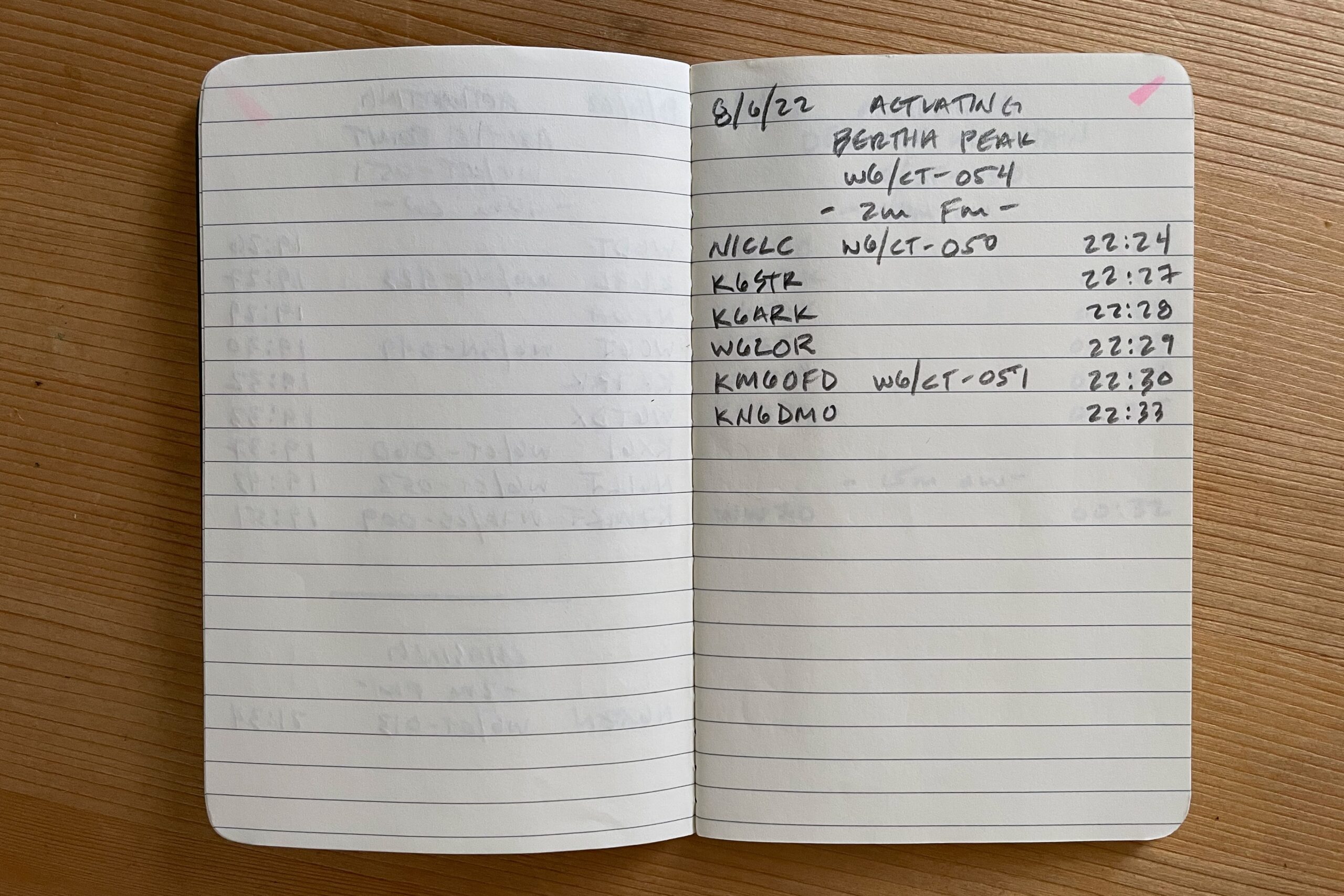
W6/CT-054
Bertha was a hot grind to the summit. Mid-day sun, and the heat reflecting off the bright rock made for a tough hike. We followed the 4WD track most of the way. I wasn’t hydrated and my lunch hadn’t kicked in yet so by the time we reached the summit, I opted to get a few contacts on VHF and call it good. Luckily everyone that was out for SoCalSOTAFest was either still on summit or back at camp, so 2M wasn’t an issue. On to the last summit of the day, Delamar.
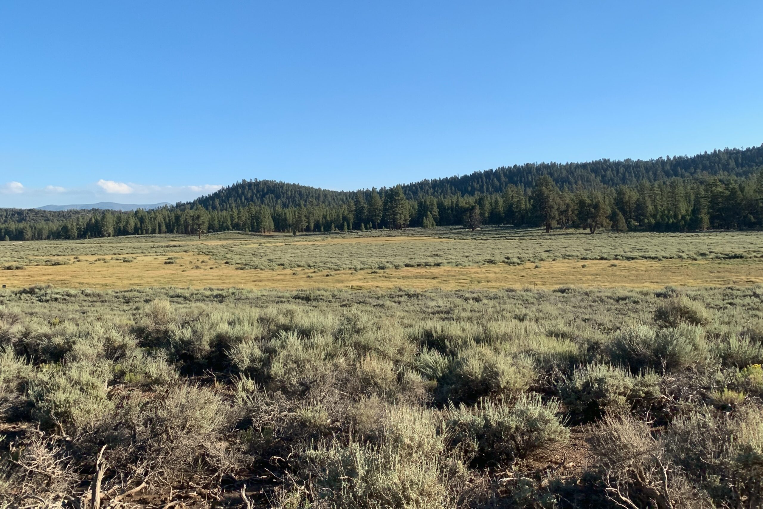
Delamar was the highlight of the day for me. The hike up Delamar was considerably more shaded than the other peaks and following the PCT for a good bit made it enjoyable. The summit is huge with lots of tree cover as well, I could have spent hours up there. Unfortunately, band conditions weren’t the greatest so after a small pileup, that was it.
All in all, it was a great day with a few good efforts to get four summits logged. Good times with Kevin, Mike, and Linda.
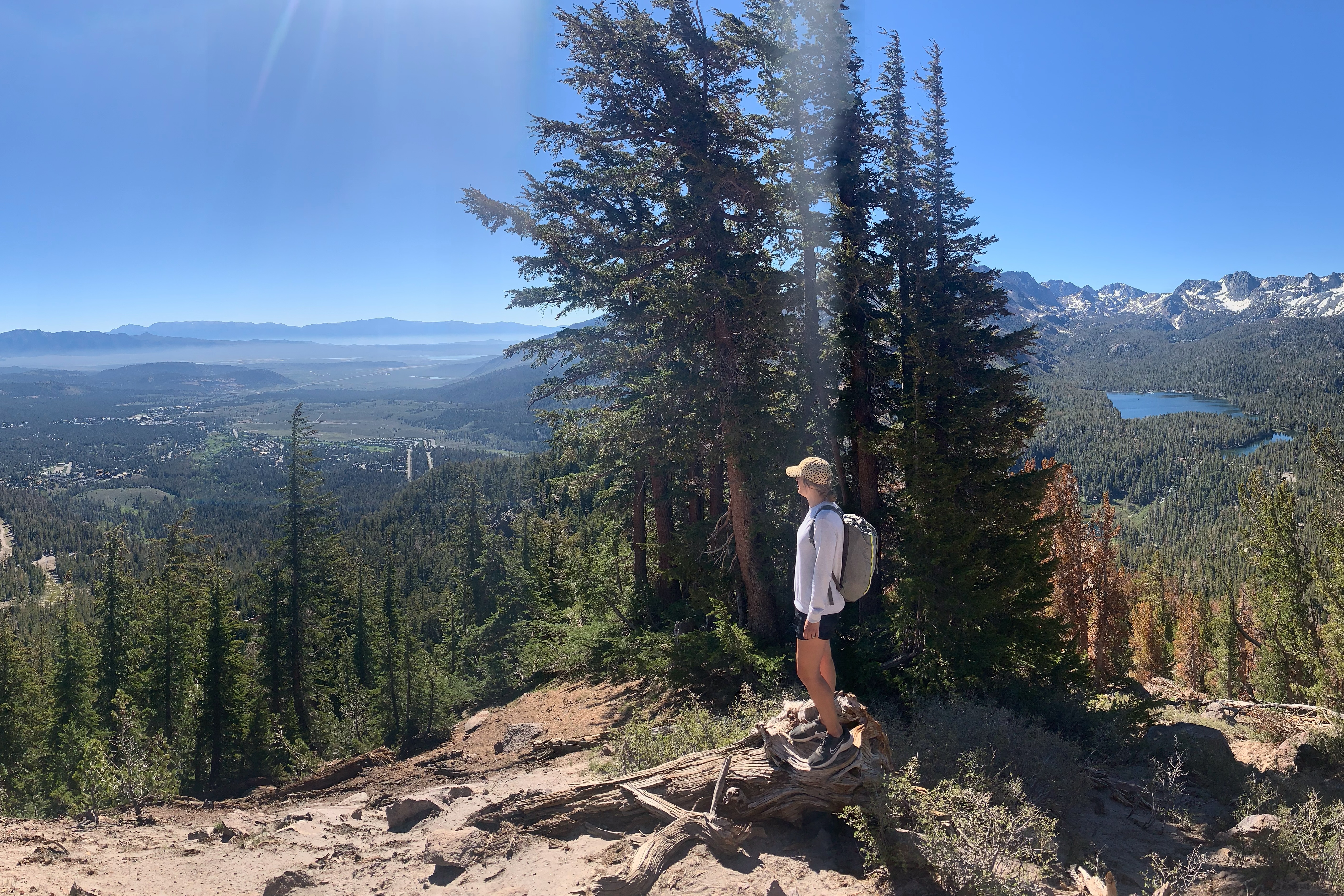
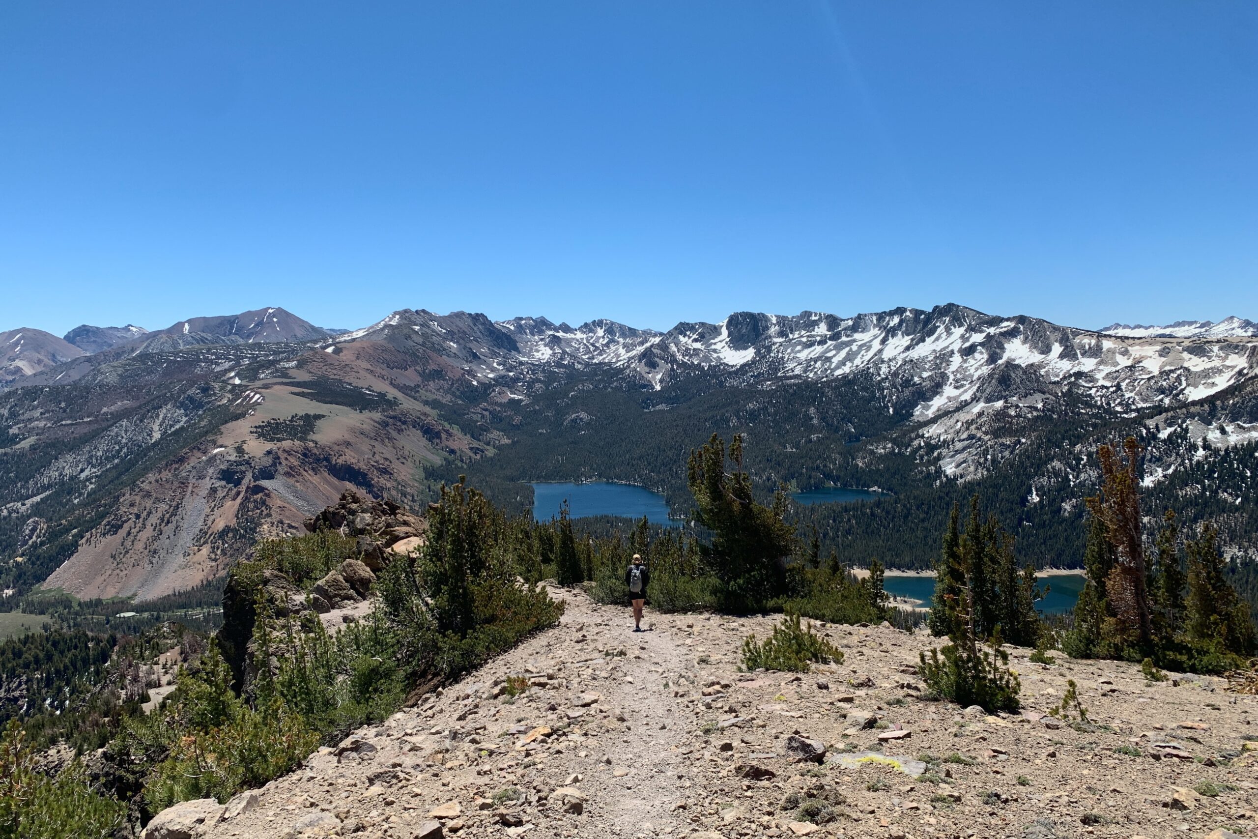
Mammoth Mountain via Dragon’s Back is a butt-kicker. We headed out from the hotel early and got to Twin Lakes Campground well before sunrise, alas, there were others even more ambitious than ourselves who took the two parking spots at the trailhead already. We drove back to the Twin Lakes general store and parked in the day-use area, walking the extra bit from the car over the trailhead.
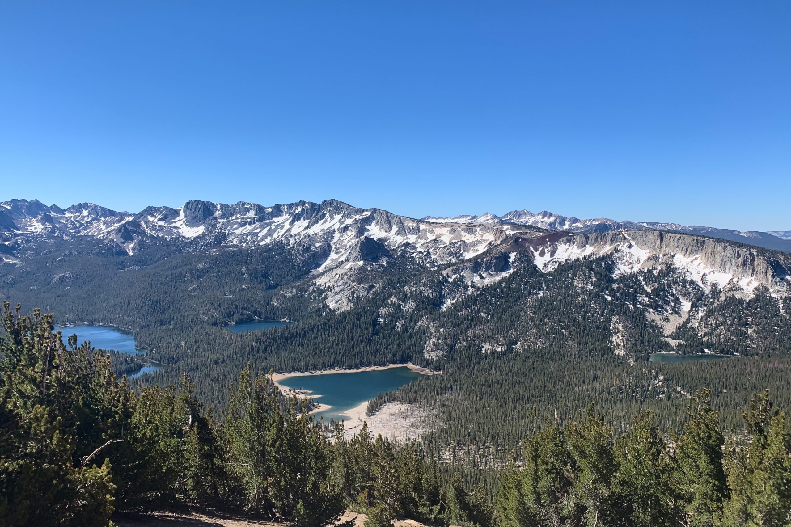
The XYL is not an avid hiker (yet) so I knew we were going to be taking it slow, and I planned for a lot of stops and snacks along the trail. She surprised me, we only stopped to take photos, and a few times, we would get some water, but overall we hoofed it to the top at a more consistent pace than I would have expected. The Dragon’s Back is an awesome route up this peak. If I were to come back, I would want to trail run this with a vest and maybe trekking poles for stability on the way back down. There aren’t many steep sections and almost no scrambling at all. The entire trail is littered with stunning views of the lakes and peaks surrounding Mammoth. I think it was an awesome experience for the XYL.
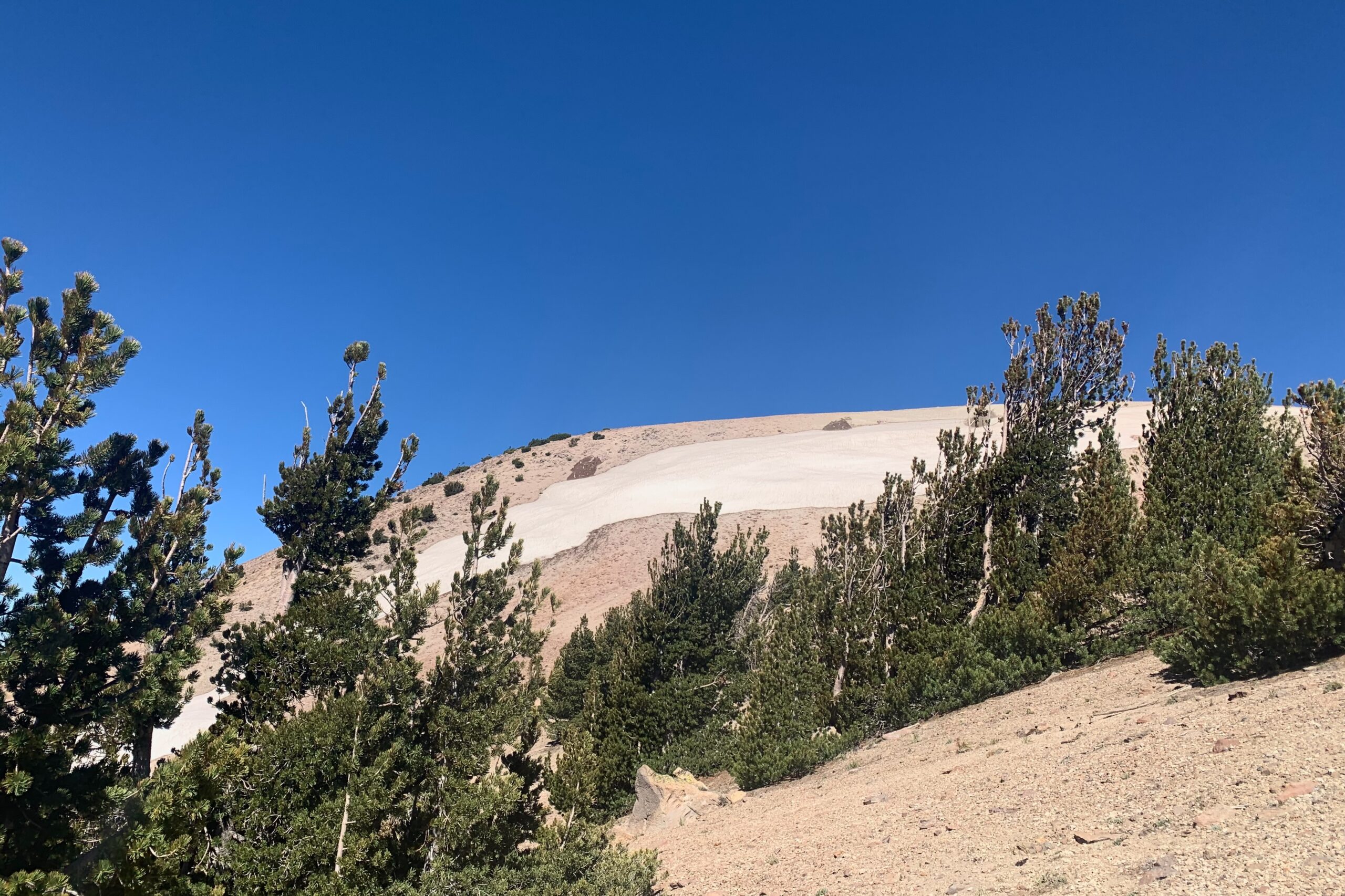
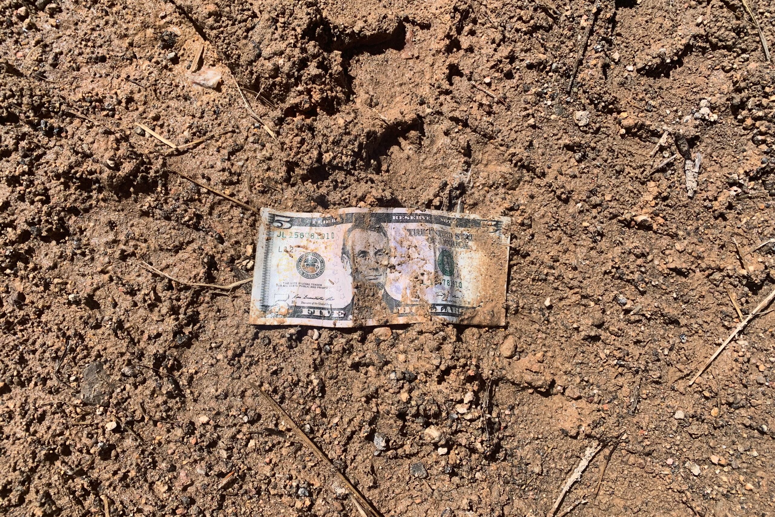
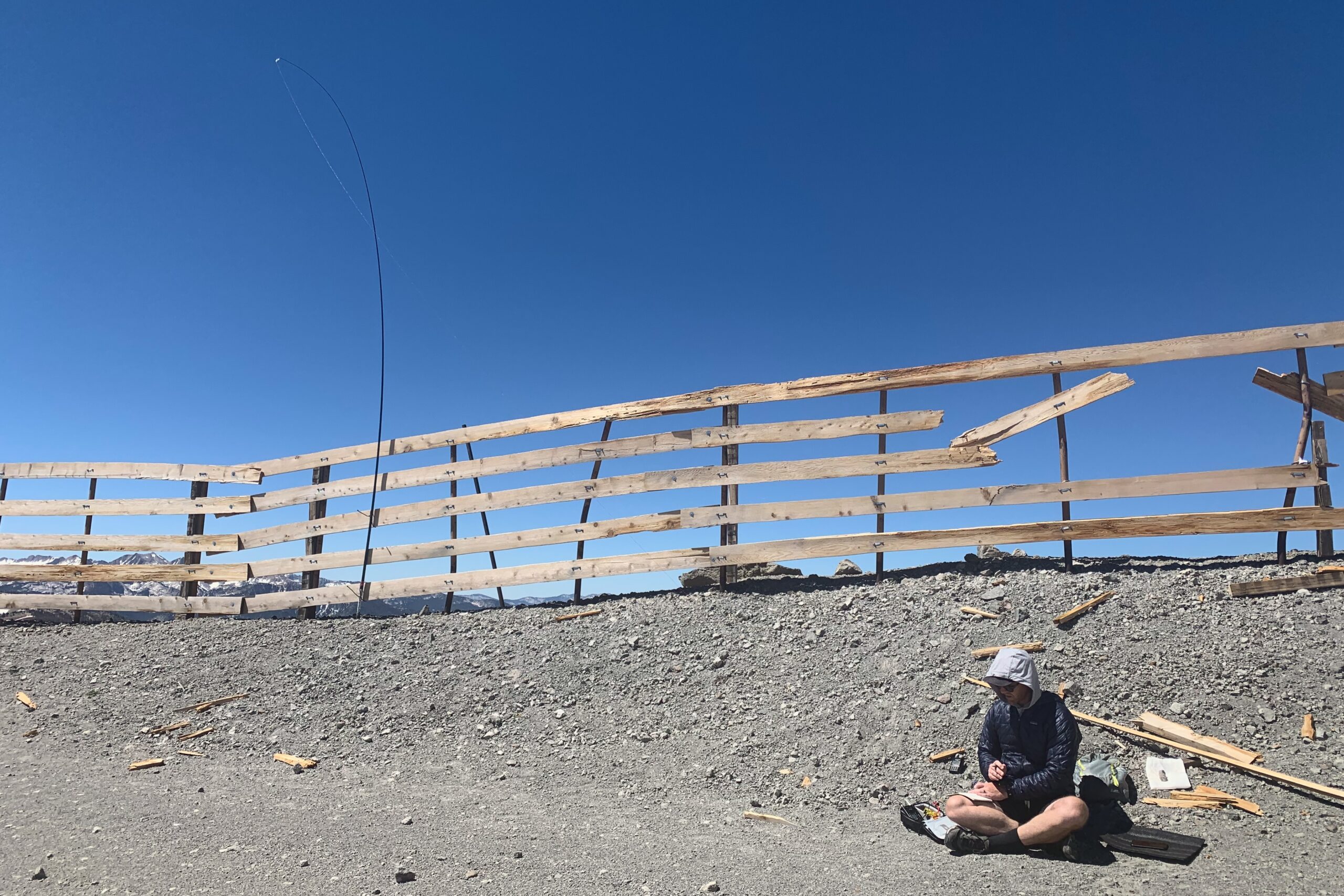
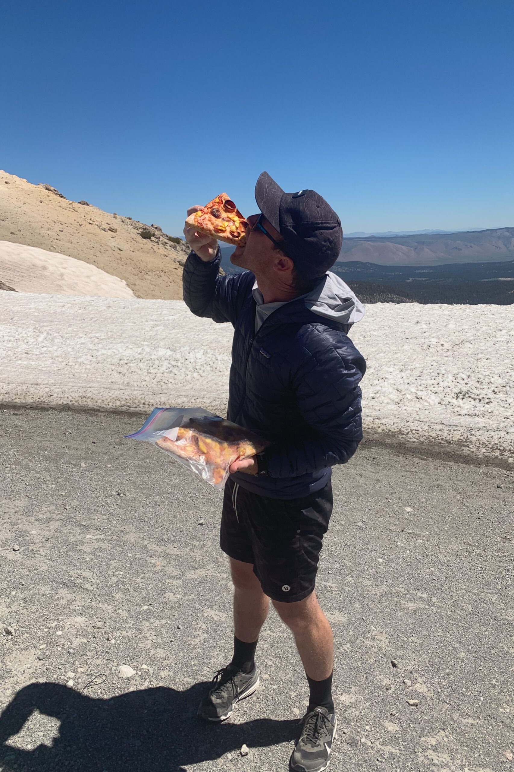
As we neared the summit, the temps dropped drastically and patches of ice started to appear along the trail. The summit was windy and cold, but the sun was out making it fairly nice to hang out for a bit. The restaurant was closed, but luckily we packed some left-over pizza. That was a good idea. The XYL also found a five-dollar bill in the mud. Things were looking up.
I set up the SW-3B and the 40M EFHW along the fence to duck out of the wind a bit. Special shoutout to Rich NU6T for the CWops classmate contact! Great to get you in the log Rich!
The XYL and I went north to Mammoth for a few days and the weather cooperated so we hit a few summits while we were there. Dry Creek Knoll (W6/ND-392) is just off the highway outside Mammoth. We took the Prius on this trip so we pulled off just far enough to park but not get stuck in what was pretty loose dirt. The summit is a straight shot up the mountain but since we were on vacation, we took the jeep track winding up around the summit making our way up the backside to the peak.
This area is scenic with views everywhere. I thought the extra distance and time spent were well worth it. Once we arrived at the summit, I found some chest-high rocks that I set the station up on. Wedging the mast into some rocks, I walked the 40m end fed out and started calling CQ. I worked a few stations on CW and packed up.
We scrambled back down to the car in almost a straight line. Lots of pine needles stuck in the shoes, but we made it back in minutes.
I was down in San Diego for work and had a few hours to kill before an event, so I drove over to this summit for a quick activation. There is a parking area just below the summit and it was busy so setting up an antenna was a bit tedious, but I ended up placing my mast behind a wall and ran the end fed along the wall so no one would get caught in it. I spotted, called CQ, and made some quick contacts on 40 meters. This was my first encounter with what is known as a “lid”. I checked to make sure the frequency was clear, so I’m not sure what I might have done to wrong this person, but I’ve added the recording of the odd behavior here. Luckily, K6CWC helped me through the interference, and I went QRT shortly after.
Let’s rewind a few months. January 22, I took both my boys as well as my dad with me on a short walk up to this peak. At the time, the only radio I owned was a VHF HT. I had planned to activate the peak, but my plans were foiled. I had spotted myself a handful of times and I called CQ for about 30 minutes straight before giving up with only 2 contacts logged. I was bummed at the time, but not for long.
Shortly after telling a few people about this failed attempt, some suggested learning Morse Code and using CW to get on some of the HF bands that were within my reach as a technician class license holder. A week later I had ordered a small, three-band, CW-only transceiver from Venus Technologies and a 3D-printed paddle from CW Morse. I also immediately signed up for the CW Academy Beginner course. All the while this failed activation was in the back of my head, but I now had found a way to circumvent this peak with poor VHF coverage.
Fast forward to the present, I learned the CW alphabet for the most part. I still get various letters confused with others and my numbers are horrible. But I have to start somewhere so why not a SOTA activation?
My plan for this activation was to do it with CW only on 40M since that’s what I can do as a technician with the equipment I currently have. Don’t let anyone make you think that you can’t operate CW as a tech. It’s possible and in my opinion, the best way to start. I got out to the peak early. I think I started calling CQ around 7:00 AM PST. The reason for this was to avoid a pileup and let me encourage you to do the same if you’re just getting started in SOTA and CW. It worked perfectly, all the QSOs were spread out evenly over about 20 minutes and no one was trying to get their call in over someone else. I could pick away at each call methodically without having the additional stress of multiple calls at once.
I digress, this is not a difficult peak to get to. Park at the end of Del Dios and take the bike path to the summit. The walk is about 5-10 minutes and there is no significant gain. Watch out for cyclists as it’s a heavily trafficked MTB area. I set up at a picnic bench just off the summit which had a nice space to run a 40m EFHW out without getting in anyone’s way.
Bear in mind that I started learning CW in February. I do appreciate how patient all the chasers were with me as I continued to ask for repeats over and over. Since this was my first CW activation, I recorded it so that I could listen to it again and check my log. Here is a clip of the first few QSOs that day.